Showing posts with label Gabilan Mountains. Show all posts

Saturday, November 22, 2014

A Mooooooo-ving View


"Moooove along," said this cow on the Juan Bautista de Anza National Historic Trail. "There's nothing to see here."

I took the photo anyway. Ha!

Come check out other black and white photos from bloggers around the world. Click here to go to The Weekend in Black and White.

Tuesday, November 18, 2014

Cows and Horses


On Sunday, the Husband and I hiked up to the one-mile post on the Juan Bautista de Anza National Historic Trail. Eventually, we'll get strong enough again to reach the bench at the crest of the mountain, which is about another two miles. It was a great hike. The cows and horses were out that day. The cows looked to be enjoying the view as much as us.

Today is Our World Tuesday. That's where I'm hanging out, checking out posts by bloggers from around the world. Come join me by clicking here.


Wednesday, November 12, 2014

Rural. Rustic. And, Red.


This gorgeous scene is from the intersection of Bolado and Southside Roads, just below Tres Pinos.

I'm hooking up with Mrs. Nesbitt's ABC Wednesday. Today's letter (I bet you guessed correctly) is R. To check out other R posts, please click here.


Sunday, September 28, 2014

Heading Up to the Clouds


Yesterday was a gorgeous day to hike the Anza Trail, a mile or so south of the City of San Juan Bautista. The trail, formally known as the Juan Bautista de Anza National Historic Trail, is 1,200 miles long, stretching from Nogales, Arizona to the Carquinez Straits in Contra Costa, California.

The local segment of the trail used to be the Old Stage Road, on which once upon a time stage coaches ran between San Juan Bautista and Salinas. The first mile of the 4.5 trail is a rather steep climb that I wonder how often passengers had to get off the coach and walk.

Today, I'm hanging out at The Weekend in Black and White. Click here to see other black and white photos by bloggers around the world.

Monday, September 22, 2014

Gorgeous San Benito County Scenery


Practically everywhere you look in San Benito County is a gorgeous scene. This is looking towards the Gabilan Mountains from the lot near Bertuccio's, off Airline Highway (aka Highway 25).


Friday, September 12, 2014

Sunset Over the Gabilan Range


I took this photo from the San Juan Oaks Golf Golf last Friday. As the sun was setting, the moon was rising behind me.

I'm hooking up at Skywatch Friday. Please click here to see sky views from around the world.

Thursday, September 4, 2014

Limekiln Monorail


Limekiln Monorail
Built in 1894 by J.J. Burt to carry "diamond brand" lime from Harlan Mt. to the S.P. Railroad at Tres Pinos.
The track was a single wooden rail. The locomotive was wood fueled steam operated. On its maiden voyage, the engine exploded while taking on water from Pescadero Creek thus ending the operation forever.  
So states this E Clampus Vitus plaque that stands towards the southern end of Cienega Road, which was erected on April 21, 1979 by Monterey Viejo Chapter 1846. 

Doesn't the idea of a monorail at the turn of the 19th century running all the way from Tres Pinos to Cienega Road just astound you? It does me. 

J.J. Burt was the owner of the Cienega Lime Works, which makes sense for the name of Limekiln Road off Cienega Road.

The New York Railroad Men reprinted an article about the monorail in its October 1891 issue, Vol. 5, No. 1, page 722. It begins: 
A curious little railroad train goes crawling up and down the mountain from Tres Pinos to Burt's lime kiln in the Gavilan range, San Benito county, every day. It is probably the strangest railroad that ever was seen; yet, thus far, not a word has ever been printed regarding it. The train moves on a curious single track and is drawn by an engine set low on it.
If you'd like to continue reading the article, click here. For a relatively more current article, check out this piece by David B. Simons Jr., that's posted at The Monorail Society website.

Saturday, August 30, 2014

Beyond


 I was back up on Cienega Road, again, enjoying the sights.

Hanging out at The Weekend in Black and White. Come join me, by clicking here.


Friday, August 29, 2014

Poetry in Motion


The fog was breaking up over the Gabilan range to the southwest of Hollister. Amazing, huh?

It's Skywatch Friday. Click here to check out what the sky looks like in other parts of the world.

Sunday, April 13, 2014


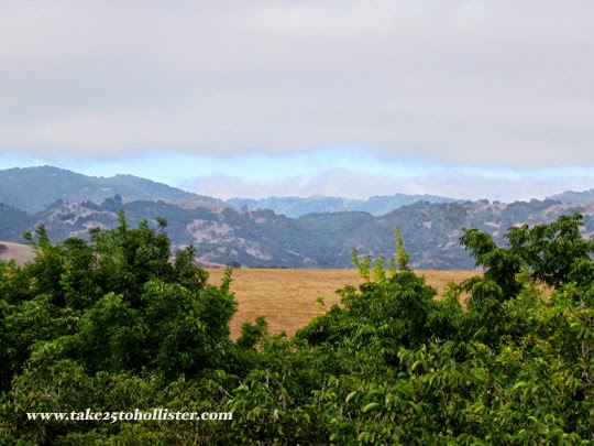
Every weekend hundreds of off-road enthusiasts drive their trucks, carrying or hauling dirt bikes and ATVs up Cienega Road to the Hollister Hills State Vehicle Recreation Area. Individuals, families, and groups come from all over the state for fun-filled rrrrrroarrrrrring up and down the Gabilan slopes.

The park was originally the Harris Ranch, owned by Howard Harris. He built many of the trails for ranching, mining, recreation, and other purposes. For many years Harris operated a private motorcycle park. In 1975 he sold his property to the state and, in October of that year, the first state vehicle recreation area park was opened.

Thursday, March 27, 2014

From Steeple to Peak


Find the church steeple on the right. See it peeking over the trees?

That's Sacred Heart Church.

See the tower high up on the Gabilan Range to the left?

Yup. That's up on Fremont Peak.

This is the view from Vista Park Hill. Gorgeous!

Do you think Fremont Peak looks too close? An illusion, you say. Perhaps. Here's the original photo from which I cropped the above one.


Friday, March 21, 2014

Coming into Hollister from the North


The Gabilan Mountains that we see beyond San Benito Street never stops to amaze me. I love how they tower over the city. I took them for granted as a kid, but then what do kids know.

ShareThis

LinkWithin

Related Posts with Thumbnails